
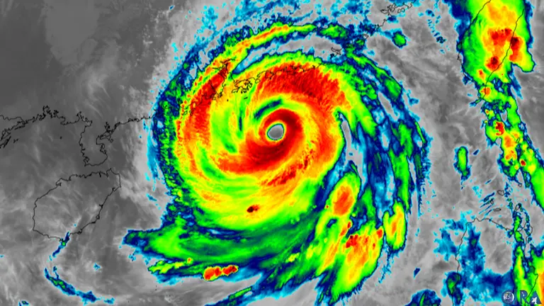
With hurricane-level winds and heavy rainfall continuing, hundreds of flights have been canceled, and a storm surge warning of up to 4 meters has been issued along the coast. The center of the typhoon is moving towards Guangdong province, brushing past the southern waters of Hong Kong.
Lagasa is assessed as the strongest typhoon in the Northwest Pacific this season. It rapidly intensified over the South China Sea after passing through northern Philippines and northern Taiwan. In the Philippines, there have been casualties and evacuations, and Taiwan has also experienced flooding and structural damage.
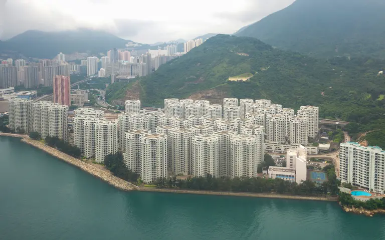
The typhoon approaching southern China has triggered the highest alerts in Hong Kong and Macau, leading to large-scale evacuations, school closures, and business shutdowns across Guangdong. The Hong Kong stock market opened under new guidelines, but urban roads and coastlines are controlled due to the risk of storm surges and falling debris.
Disruptions in transportation, including air, rail, and ferry services, have spread widely. Hong Kong International Airport began phased flight suspensions from the previous day, resulting in numerous flight cancellations, and the railway network, including West Kowloon Station, has seen cancellations and delays.
Large supermarkets have seen a surge in pre-stocking demand, and some commercial facilities and casinos have closed for safety reasons. Authorities are operating dozens of shelters and advising residents in low-lying coastal areas to relocate. Industrial zones across Guangdong are likely to face disruptions in factory operations and logistics.
Weather satellite observations show that Lagasa has rapidly developed into a very strong storm after forming in the western Pacific in mid-September. The central pressure is dropping rapidly, and the wide wind field raises concerns that even without direct landfall, it could cause devastating waves and strong wind damage throughout the city. There are also concerns that flooding, power outages, and port damage recorded during Typhoon Hato in 2017 and Typhoon Mangkhut in 2018 could be repeated.
The impact on Korea can be summarized in two ways. First, current forecasts indicate a low possibility of direct landfall on the Korean Peninsula, but high waves and strong winds are expected, particularly in the southern seas and Jeju, necessitating special attention to maritime safety and management of low-lying coastal areas.
Second, the shutdown of the Zhujiang Delta industrial belt may delay shipments of certain items such as electronics, batteries, and textile components, prompting domestic companies to check their inventory and alternative transport routes. The possibility of flight changes from Hong Kong and Guangzhou should also be considered. This incident will serve as an opportunity for port cities like Busan and Incheon to reassess their underground flood management, power outage preparedness, and evacuation procedures for vulnerable populations. It is becoming clear that the ability to recover quickly is a key aspect of a city's competitiveness.

![[Scenario] 2026 Global Wildfire Calendar: The Unending Cycle of Flames](https://cdn.breathjournal.com/w400/q80/article-images/2025-10-01/83cbd0d7-c7c9-4101-b4f6-e39cff028d87.png)

![[Focused Planning] 2026 Global Wildfire Calendar, Facing a Charred Future](https://cdn.breathjournal.com/w400/q80/article-images/2025-10-01/5be639f5-d684-4605-acb1-e0127c554e7c.png)

댓글 (0)
댓글 작성
댓글을 작성하려면 로그인이 필요합니다.
로그인하기